Radar Volume Explorer
RadarVolumeExplorer is a 3D visualization tool for meteorological radar
data. It can visualize the scan slices in PPI mode (Flat Model), in CAPPI
mode (Cartesian Model) and in Isometrical View.
How does it work?
How does it work?
RadarVolumeExplorer has three ways of visualizing volume datasets:
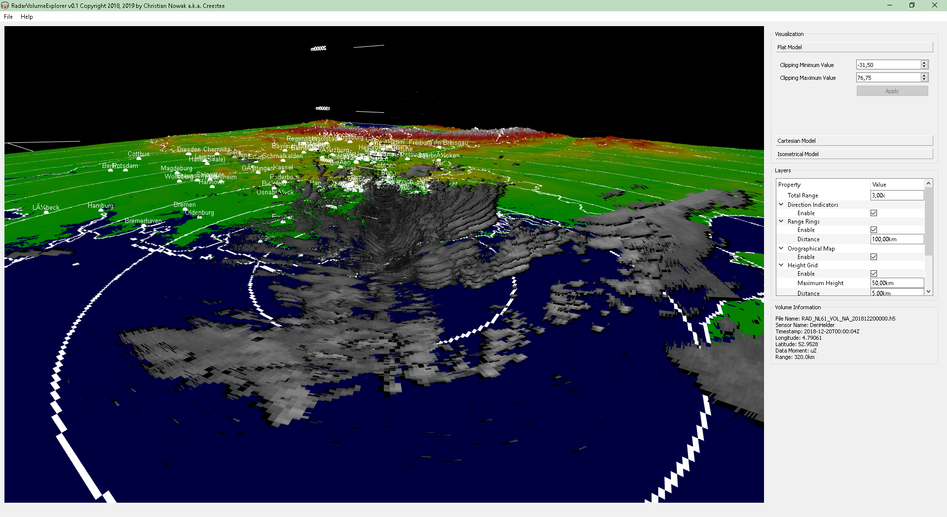
- Flat Model:
In this model, each azimuthal scan of the whole volume dataset is
visualized as-is in 3-dimensional space, very much like a set of
PPI (Plan Position Indicator) images.
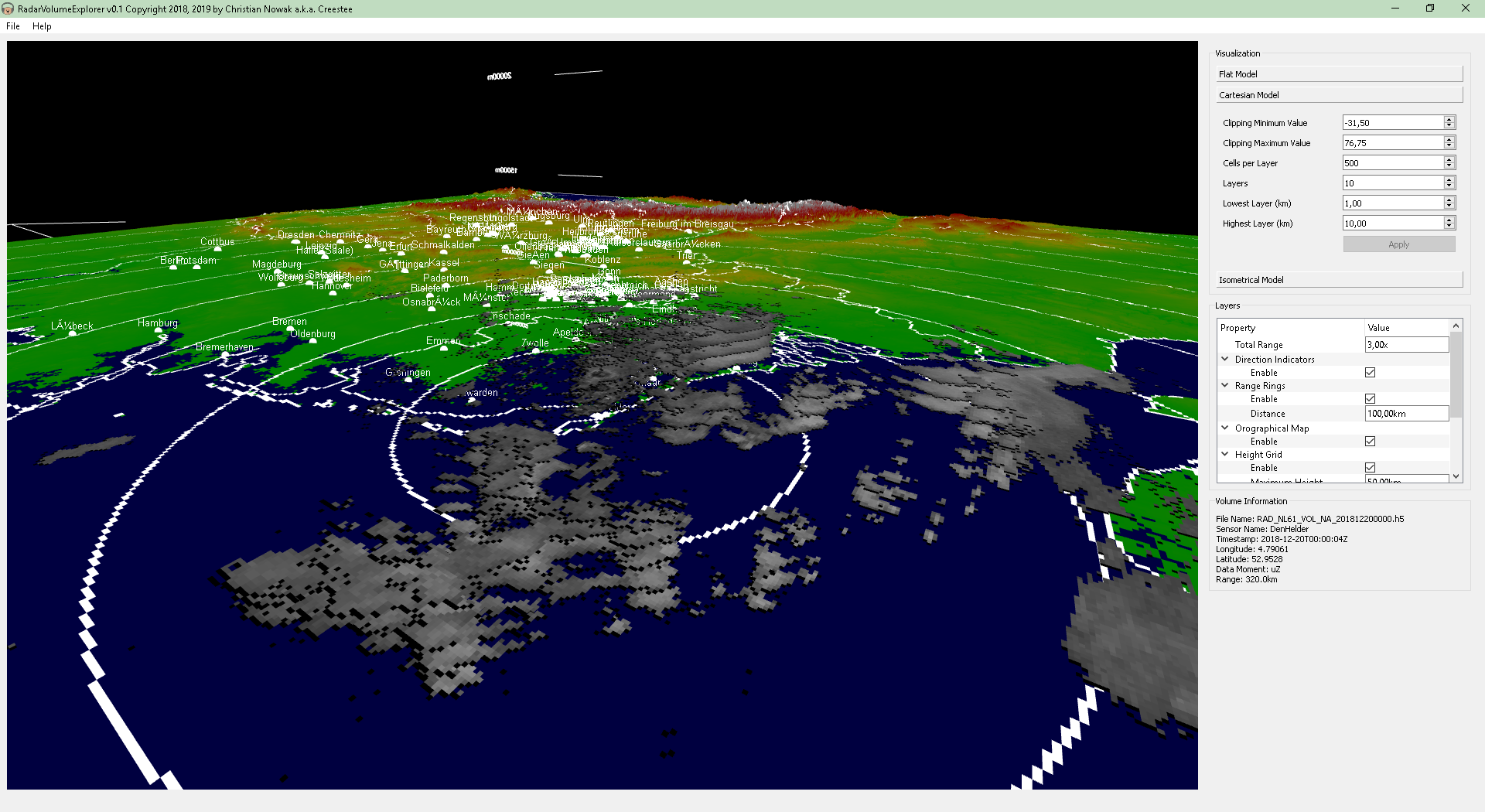
- Cartesian Model:
In this model, RadarVolumeExplorer generates a set of CAPPI (Constant
Altitute Plan Position Indicator) images at different heights above the
radar position which are then visualized as-is in 3-dimensional space.
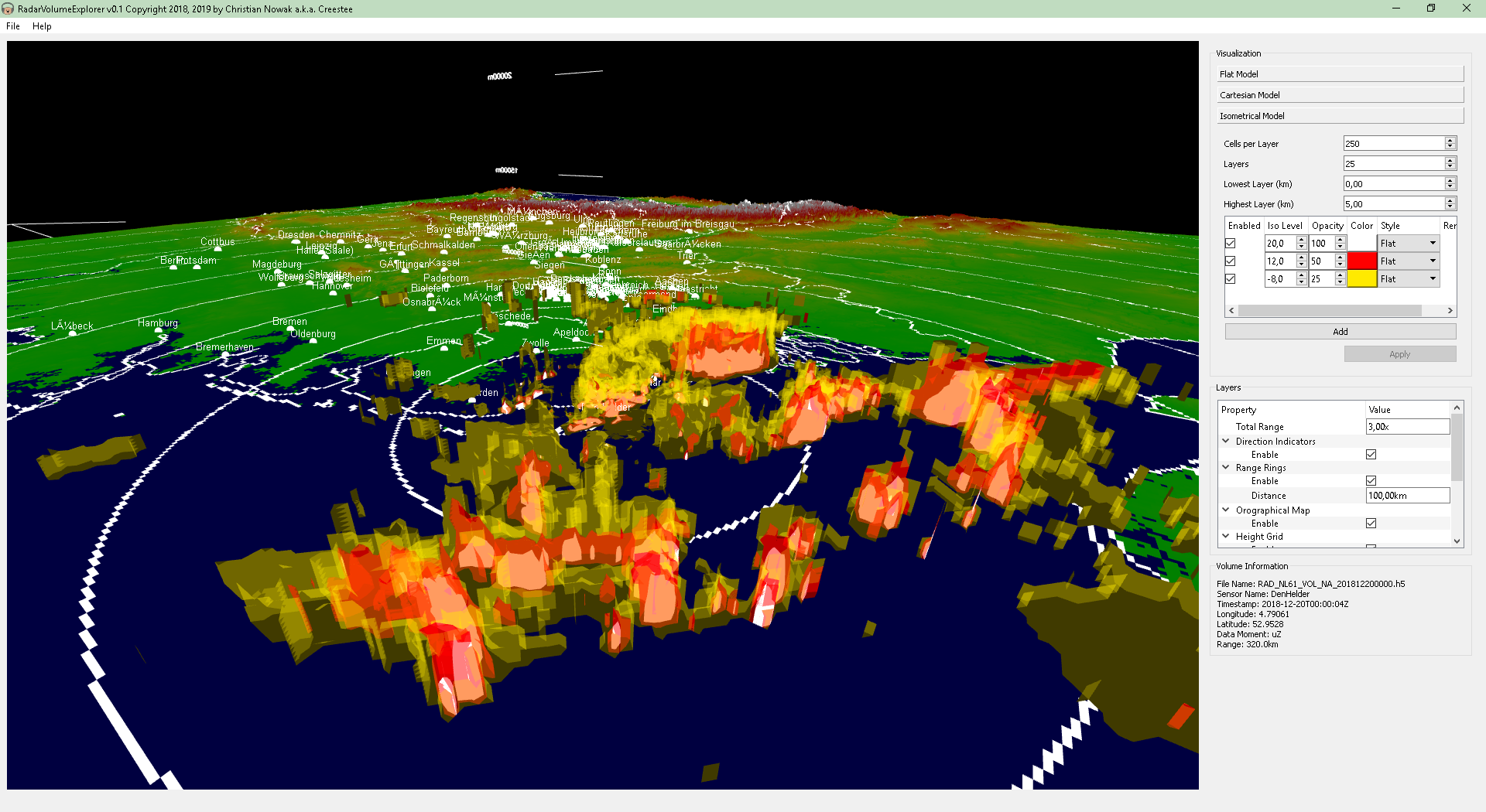
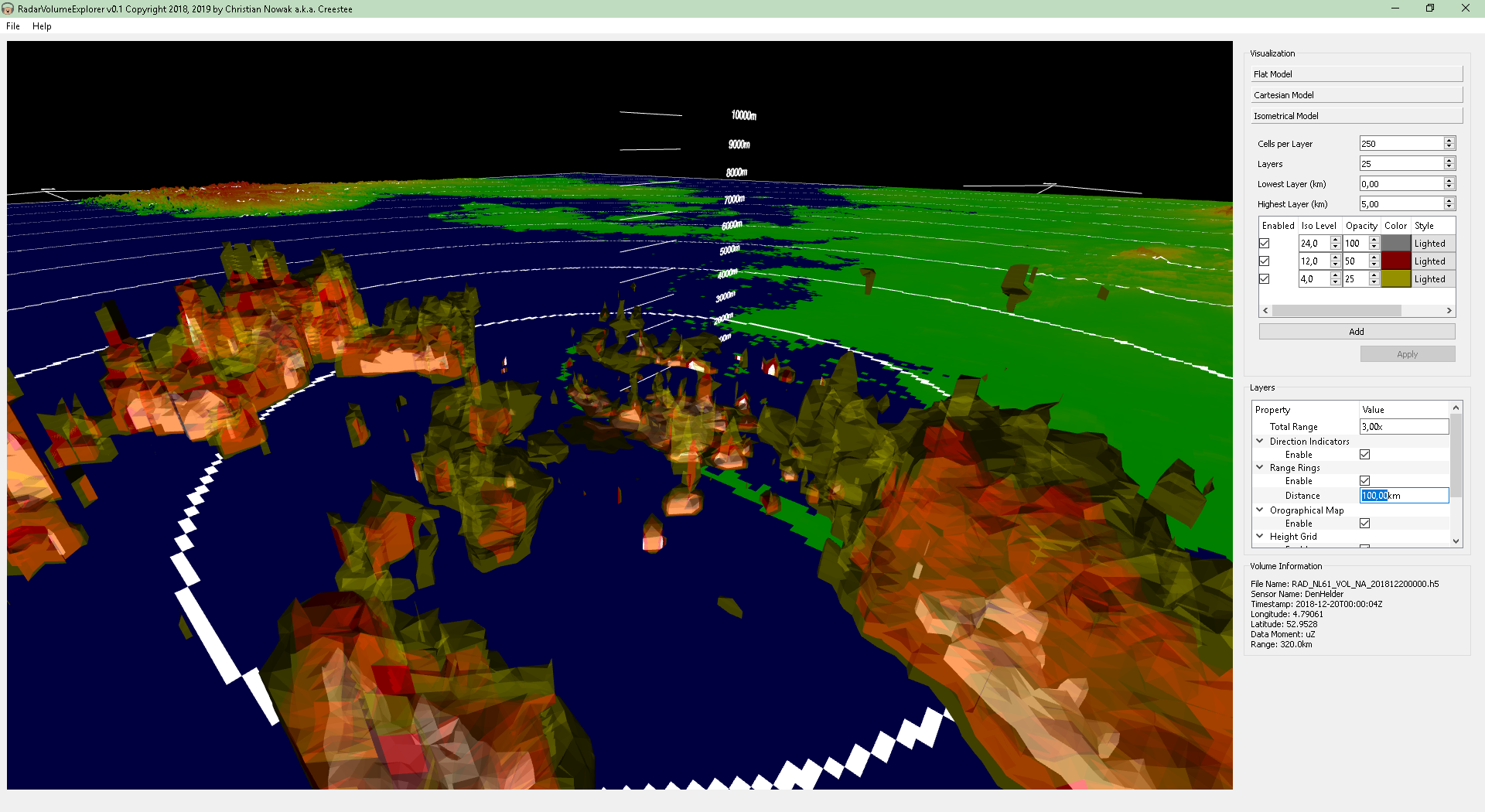
- Isometrical Model:
This model showcases the main reason why I wrote this program in the
first place 
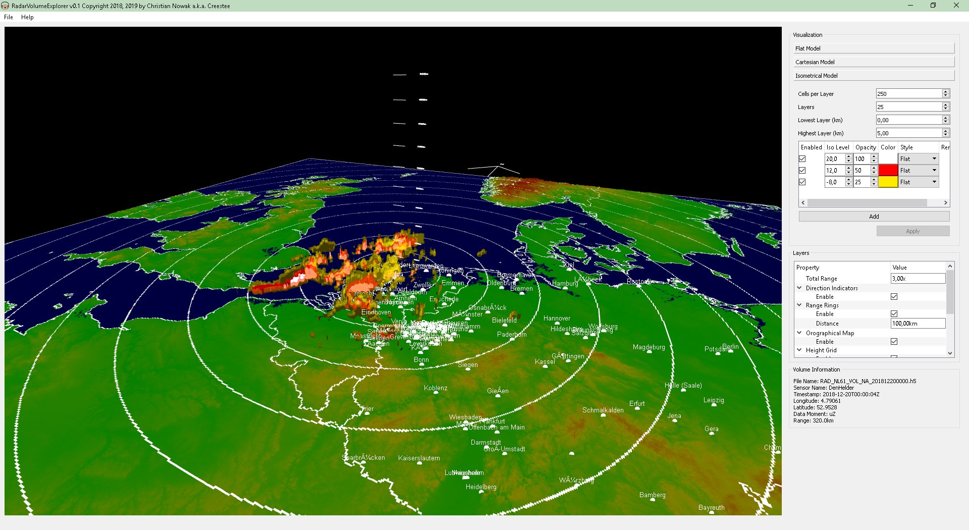
The isometrical model generates isosurfaces by using the
Marching Cubes  algorithm also used in medical imaging applications. You can generate a
number of such isosurfaces with different threshold values, colors and
transparencies.
Further Features
- Supports radar data files:
HDF5 format  using the
KNMI v3.6
  or the
ODIM 2.2
  specifications. KNMI (Royal Netherlands Meteorological Institute)
provides recent radar data from several radars on their
FTP server
  .
.
- Topographical data in DEM (Digital Elevation Model) format.
You can download the SRTM30 DEM set from the following locations:
- GIS (Geographic Information System) data in ESRI *.shp and *.dbf format
 .
You can download such shapefiles here:
Downloads
- Binary distribution (Windows 32bit):
RadarVolumeExplorer_v0_0_1-bin-win32.7z  (131MB)
- Source code:
RadarVolumeExplorer_v0_0_1-src.7z  (9.71MB)
In this model, each azimuthal scan of the whole volume dataset is visualized as-is in 3-dimensional space, very much like a set of PPI (Plan Position Indicator) images.
In this model, RadarVolumeExplorer generates a set of CAPPI (Constant Altitute Plan Position Indicator) images at different heights above the radar position which are then visualized as-is in 3-dimensional space.
This model showcases the main reason why I wrote this program in the first place

The isometrical model generates isosurfaces by using the Marching Cubes
 algorithm also used in medical imaging applications. You can generate a
number of such isosurfaces with different threshold values, colors and
transparencies.
algorithm also used in medical imaging applications. You can generate a
number of such isosurfaces with different threshold values, colors and
transparencies.HDF5 format
 using the
KNMI v3.6
  or the
ODIM 2.2
  specifications. KNMI (Royal Netherlands Meteorological Institute)
provides recent radar data from several radars on their
FTP server
  .
.You can download the SRTM30 DEM set from the following locations:
 .
You can download such shapefiles here:
.
You can download such shapefiles here:RadarVolumeExplorer_v0_0_1-bin-win32.7z
 (131MB)
RadarVolumeExplorer_v0_0_1-src.7z
 (9.71MB)
Copyright (c) by chn.
All material available on this website is free of charge for personal use.
There are no ads and no affiliate links on this website.
No cookies are used. You are not being tracked.
Legal Notice


All material available on this website is free of charge for personal use.
There are no ads and no affiliate links on this website.
No cookies are used. You are not being tracked.
Legal Notice


